© 2013 MarketviewSolutions.
Site Plan Imager and
MarketviewSolutions.are not affiliated with Google or any of their subsidiaries. Site Plan Imager provides an imagery processing service which is designed to work within a properly licensed version of Google Earth or Google Earth Pro. By using this website or our services, the user agrees that it has full rights to use and distribute any imagery provided to Site Plan Imager or MarketviewSolutions., and user is not in violation of any Copyright, Licening or Confidentiality laws or restrictions.
Site Plan Imager
The following examples illustrate different ways site plans and site based imagery can be imported by Site Plan Imager and manipulated in Google Earth. All of these examples can be downloaded onto your computer so you can see how our service works for your self.

Before you download them, make sure you have an installed version of
Google Earth on your computer. If not, download it here: http://earth.google.com
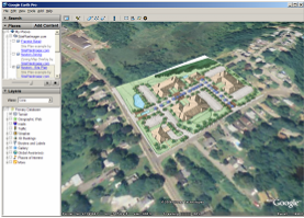
Residential Site Plan

This is an example of a site plan that has been imported into Google Earth.

Once you download this example you can pan, zoom, tilt and rotate the site plans.
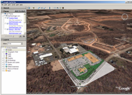
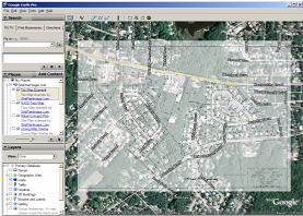
Retail Concept Plan

This is second site plan example. This shows the site's proximity to a major offsite residential development.

This is an excellent way to illustrate site amenities that are not visible on the site plan alone.
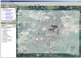
Zoning Map Overlay

In this example, the Zoning Map for an entire town is brought into Google Earth.

This is a useful tool to identify specific land use zones within a municipality and shows how our services can manipulate imagery for large-scale regions.
Tax Map Overlay

Tax Maps can be brought in to allow you to identify and annotate parcels and measure exact acreage.

This is an excellent way to identify and measure parcels you are interested in.
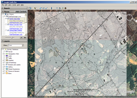
NJGS Topo Map

Here is another example of a large-scale image process. This is a topographic map published by the NJ Geologic Survey

Government resources make extensive libraries of information available. This info can be imported and used to evaluate properties and parcels.
Home
How does it work?
Examples?
How do I order?
After you select your example to download, you will see the following screen:
Click Open to view the selected example file. If Google Earth is not running it will start up automatically. If you have any troubles downloading or viewing the image email us or call 862-684-8899 for assistance. Want to know how to order?